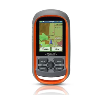
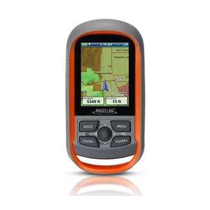
Detail GPS MAGELLAN EXplorist 310,,, HARGA DEALER 021.7321129
Easy to Navigate Menus and Rich Graphics
A simple main menu, intuitive contextual menus, and vibrant graphics make this device easy to use
Brilliant, sunlight readable color screen
A vibrant 2.2” color transflective screen provides the best readability in direct sunlight
Rugged and waterproof to IPX-7 standards
Focus on the adventure not protecting the device
High-sensitivity SiRFstarIII GPS with 3-5 meter accuracy
3-5 meter GPS accuracy provides a superior navigation experience
Pre-loaded World Edition Map
Referencing a complete road network in North America and Western Europe and major roads throughout the rest of the populated world to help in orientation. See parks, rivers, lakes, major city points, and other types of land use areas.
18 Hours of battery life using 2 AA batteries
Go strong for an entire day ( or more) . No stopping to replace the batteries.
Suspend Mode
The goal is to conserve battery life by putting the device into an advanced power saving mode. Suspend mode will turn off everything except for GPS tracking. Wake up the device with a single click.
Paperless Geocaching
Download and view more than 20 unique characteristics of each cache and view, search, filter on the device. Details include name, location, description, hider, size, difficulty, terrain, hint, spoilers, and last 20 user logs among a number of other details.
500 megabytes of user memory available
Loads of space to store additional maps, geocaches, waypoints, and tracks.
Record Tracks and See “ Breadcrumbs” on the Map Screen
Keep a log of all the steps you took throughout the day. Reference your track to find your way back or to keep a digital journal of all your outdoor adventures
Track Summary
Start your journey with one-click and keep tabs on useful statistics such as distance travelled, average speed, elevation gain and descent, and average time to find
NMEA Message Output ( USB Only)
For hardcore outdoor GPS enthusiasts who want to connect their device to laptop running VantagePoint software and see your position on computer screen.
Multiple Coordinates and Map Datums
Navigate around the world and do it accurately. See your geographic location in UTM coordinates or reference the OS Grid for use in Great Britain
Tampilkan Lebih Banyak